



SaaS Cloud Platform (Low-Altitude Situation Awareness Command Center)
Product Positioning
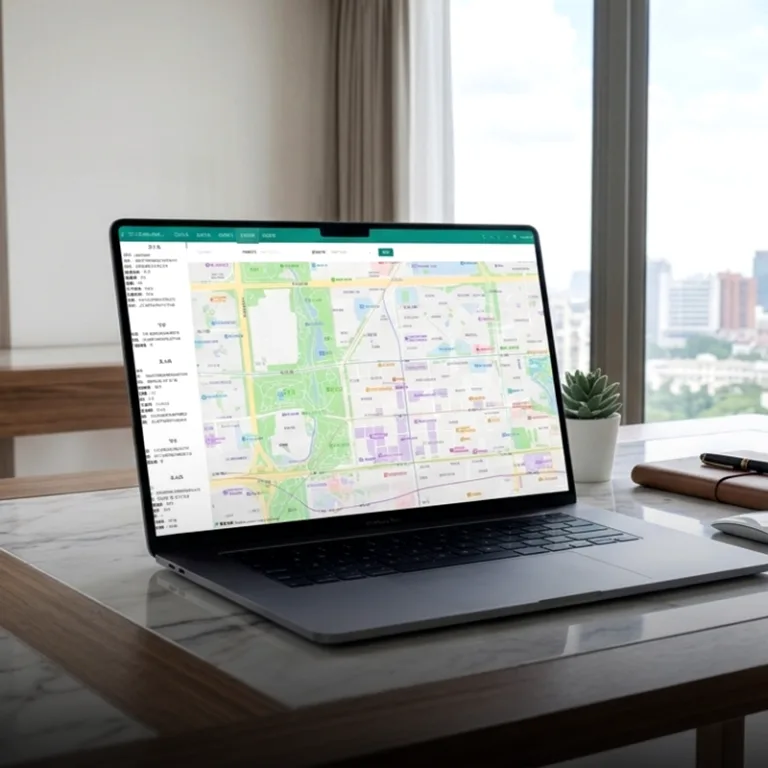
The SaaS Cloud Platform serves as the data aggregation hub and command & control center of the Tiruo Innovation low-altitude security system. Data from three terminal types – Fixed Sentry Terminal (YunScan-F1), Handheld LingSearch Terminal (YunScan-Y1), and Airborne SkyEye Terminal (YunScan-Air) – are all aggregated to the cloud platform via the MQTT 5.0 protocol. Equipped with functions including situation visualization, hierarchical alarm notification, device management, trajectory playback, and statistical reporting, the platform delivers command and decision-making support for public security bureaus, airports, government authorities, energy facilities and other scenarios.
Core Capability Matrix
| Module | Function | Description |
|---|---|---|
| Situation Large Screen | Supports Amap / Google Maps base maps; overlays device distribution, target positions and alarm hotspots in real time | Displays global airspace situation on a single screen, compatible with large display walls in command centers |
| Target List | Structured presentation of Remote ID data: SN code, longitude & latitude, altitude, speed, heading angle, pilot location | Structured parsing and visualization of Remote ID information |
| Trajectory Playback | Replay full historical drone trajectories by incident for evidence review and post-analysis | Historical track playback for case investigation and review |
| Alarm Center | Geofence violation alerts, blacklist/whitelist rules, SMS notifications; customizable push rules by department role | Automatic alarm dispatch to reduce manual monitoring workload |
| Device Management | Online/offline status, firmware version, operation & maintenance status | Equipment operation management to cut on-site maintenance costs |
| Organization & Permission Control | Multi-organization, multi-role, hierarchical authorization, operation audit logs | Tiered permission management for multiple organizations and user roles |
| Statistical Reporting | Daily/weekly/monthly statistics, hotspot area analysis, alarm proportion breakdown, drone model analysis, exportable reports | Auto-generated statistical charts and tables with export & scheduled email delivery support |
| Navigation Distribution | Generate QR codes for incidents; scan to jump to Amap navigation | QR code-based navigation dispatch for alarm events |
Core Values
- Closed-loop workflow: Signal detection → incident generation → alarm dispatch → on-site disposal → post-event review
- Unified management of multi-site equipment: Cross-region and cross-department centralized operation
- Data assetization: Storable and reusable low-altitude airspace situation data
Detailed Functional Introduction
Situation Large Screen
- Switchable base maps: Amap for domestic use, Google Maps for overseas deployment
- Real-time overlay of all three terminal types: Fixed Sentry (YunScan-F1), Handheld LingSearch (YunScan-Y1), Airborne SkyEye (YunScan-Air)
- Real-time drone target rendering: Position, altitude, speed and heading; icons rotate to match flight direction
- Alarm hotspot heatmap to mark intrusions into sensitive zones
- Multi-screen linkage and video wall splicing support to meet command center display requirements
Target List
- Structured parsing of complete Remote ID data:
- Device info: SN code, manufacturer, model, serial number
- Flight status: Longitude & latitude, altitude (MSL / AGL), flight speed, heading angle
- Pilot info: Pilot coordinates, linear distance between pilot and drone
- Real-time refresh interval: ≤ 1 second
- Sort and filter targets by distance, altitude or alarm level
Trajectory Playback
- Select time ranges by incident to replay full drone flight tracks
- Track points display timestamps, speed and altitude; variable playback speed available
- Simultaneous multi-drone playback with differentiated color coding
- Export trajectory data in CSV / KML formats for formal evidence reports
Alarm Center
- Boundary violation alerts: Triggered when drones enter pre-defined electronic fences or sensitive restricted zones
- Whitelist & blacklist mechanism: Whitelist filters legal drones; blacklist flags high-risk illegal targets
- Role-based customized push rules: Each department/role can configure dedicated notification channels (platform pop-ups, SMS, etc.) for precise alert delivery
- Two-stage SMS notification: First SMS informs users of incident occurrence; second SMS delivers full incident summary
Device Management
- Unified asset ledger for all three terminal types: Device name, serial number, deployment location, responsible person
- Real-time status monitoring: Online / Offline / Alarm, last heartbeat timestamp
- Firmware version control with batch upgrade strategies
- Operational parameter monitoring: Signal strength, equipment temperature, battery level, network connectivity
- Automatic equipment fault alerts with auto-generated maintenance work orders
Organization & Permission Control
- Multi-level organizational architecture: Group headquarters / branch offices / project departments
- Multi-tier user role system: Super Administrator / Regional Administrator / Duty Operator / Observer
- Data isolation: Each organization can only view data from its own managed devices
- Full operation audit: All user actions are logged for traceability and compliance audit
Statistical Reporting
- Auto-generate daily/weekly/monthly statistical reports covering:
- Alarm trend charts (time-dimension analysis)
- Hotspot area distribution (geographic analysis)
- Alarm type proportion (boundary violation / blacklist hit / sensitive zone intrusion)
- Drone model distribution statistics (DJI / Autel / other brands)
- Exportable to PDF / Excel with embedded charts and data tables
- Scheduled automatic report delivery to designated mailboxes
Navigation Distribution
- Auto-generate incident QR codes containing target coordinates, event description and priority level
- Scan QR codes to open Amap and navigate directly to the drone or pilot location
- One-click mass dispatch to multiple on-duty personnel’s mobile phones
- Linkage with mobile App to form a closed workflow: Alarm reception → navigation guidance → on-site disposal
Data Aggregation Architecture (Unified Data Entry for Three Terminals)
Key Rules
- The SaaS Cloud Platform is the only unified aggregation gateway for data from Fixed Sentry (YunScan-F1), Handheld LingSearch (YunScan-Y1) and Airborne SkyEye (YunScan-Air).
- Mobile App only displays data from handheld terminals; DJI Pilot 2 Plugin only displays airborne terminal data. Neither serves as a centralized data aggregation hub.
- Multi-source data fusion on the cloud platform: Automatically deduplicate, correlate and merge tracks when one target is detected by multiple devices.
Collaborative Logic of Three Terminal Types
| Terminal | Core Role | Coverage Mode | Final Data Destination |
|---|---|---|---|
| Fixed Sentry (YunScan-F1) | Permanent base coverage | 24/7 continuous monitoring & key zone alarm triggering | SaaS Cloud Platform |
| Handheld LingSearch (YunScan-Y1) | Mobile blind spot filling & on-site disposal | Dynamic coverage following patrol staff movement | Mobile App → SaaS Cloud Platform |
| Airborne SkyEye (YunScan-Air) | Large-area rapid scanning | Air-ground integrated detection with obstacle penetration capability | DJI Pilot 2 → SaaS Cloud Platform |
End-to-End Data Transmission Links
- Fixed Sentry (YunScan-F1): Ethernet / 4G Cat1 → MQTT 5.0 → SaaS Platform
- Handheld LingSearch (YunScan-Y1): Bluetooth → Mobile App → 4G/5G → MQTT 5.0 → SaaS Platform
- Airborne SkyEye (YunScan-Air): OcuSync → DJI Remote Controller → Cellular Network → MQTT 5.0 → SaaS Platform
All data from the three terminals converges uniformly on the SaaS Cloud Platform, enabling multi-source data fusion, unified alarm management, centralized permission control and integrated post-event review. The system builds a full-coverage low-altitude monitoring network combining fixed stationary stations, portable handheld equipment and aerial inspection drones.
Typical Application Scenarios
| Scenario | Operation Mode | Explanation |
|---|---|---|
| Public Security Command Center | Large display wall + duty officer workstations | Global city airspace visualization; automatic alarm push by department responsibilities |
| Airport AOC | Air traffic control room + security department | Real-time clearance zone monitoring with compliant evidence collection |
| Government Agencies / Industrial Parks | Security office & logistics command center | Daily security and major conference support, compatible with command center large screens |
| Energy Group Headquarters | Multi-factory data aggregation | Group-level unified management and cross-region joint response |
| Major Event Command Post | Temporary command center + large display wall | Unified air-ground coordination during large-scale activities |
| Emergency Response Center | Emergency duty workstations + display wall | Rapid response to sudden incidents and cross-regional resource scheduling |
Compliance Standards
- National Standard of China: GB 42590-2023 Safety Requirements for Civil Unmanned Aircraft Systems
- EU Standard: ASD-STAN prEN 4709-002
- US Standard: ASTM F3411
- Communication Protocol: MQTT 5.0 for real-time data aggregation
- Deployment Options: Supports private deployment, with all data stored on the customer’s private servers to meet data security and regulatory compliance requirements