



DJI Pilot 2 Plugin (Exclusive Display Terminal for Airborne Terminal)
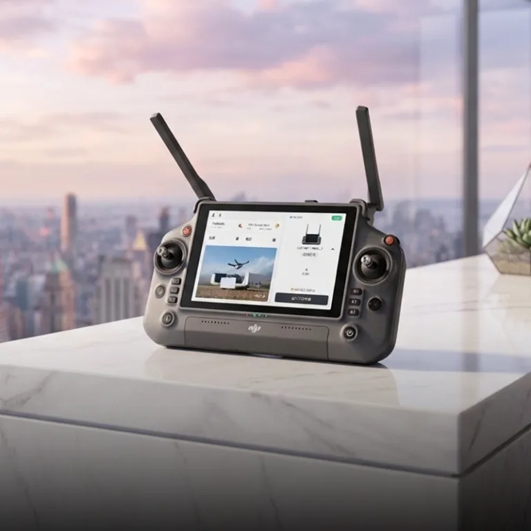
Product Positioning
The DJI Pilot 2 Plugin serves as the dedicated display terminal for the Airborne Terminal · SkyEye (YunScan-Air), running on the DJI RC Plus 2 remote controller. Via the DJI OcuSync video transmission link, the plugin receives Remote ID data detected by the SkyEye module and displays it in real time on the remote controller screen, allowing pilots/mission operators to view airspace situational awareness mid-flight. Meanwhile, data is transmitted to the SaaS cloud platform through the remote controller’s cellular network, forming a complete data chain: Airborne Detection → Real-time Display → Cloud Aggregation.
Important Restriction: The DJI Pilot 2 Plugin only displays data detected by the airborne SkyEye terminal; it cannot show data from fixed Sentry terminals or handheld LingSearch terminals. The plugin acts solely as an exclusive display terminal for airborne equipment, not a centralized data aggregation hub.
Core Function Matrix
| Module | Function | Remarks |
|---|---|---|
| Global Overview Panel | Four-zone layout (Status Bar + Overview List + Detail Panel + Operation Buttons); supports simultaneous display of no less than 20 aircraft targets | Only displays targets detected by airborne terminals |
| Instant Target Switching | Response time ≤ 200ms for Previous/Next target switching; jump to target details by clicking list entries | — |
| Multi-Target Trajectory Display | Simultaneously render flight trajectories of over 10 aircraft on one screen with unique blue color coding; supports timeline playback for historical review | — |
| Mission Logging | Automatically record mission start & end time, aircraft list, track point sequences and signal strength fluctuations; supports export in CSV/Excel/TXT formats and date-based retrieval | — |
| RID/DID Fusion Recognition | Automatic association and merging of Remote ID and detected identities; prioritize complete information display with auto-completion of missing fields; association accuracy ≥ 95% | — |
| Internationalization Adaptation | Toggle between Chinese and English interfaces; overseas version compatible with Google Maps / OpenStreetMap; date format auto-adjusted per regional customs | — |
| Hardware Coordination | RF antennas routed from both sides to avoid signal blockage; rear-shifted equipment center of gravity for flight safety; operates collaboratively with DJI Pilot App | — |
Detailed Functional Introduction
Global Overview Panel (Four-Zone Layout)
- Target switching response time: ≤200ms, with zero interference to flight operations
- Click any target in the list to instantly refresh the detail panel on the right
- Support follow/unfollow target operations; followed targets are pinned to the top of the list
Multi-Target Trajectory Visualization
- Render real-time flight trajectories of over 20 aircraft simultaneously on-screen
- Each aircraft assigned an exclusive color shade to avoid visual confusion
- Trajectory lines labeled with timestamps and directional arrows
- Timeline playback support: drag the progress bar to review airspace conditions at any historical moment
- Trajectory data exportable to KML / CSV formats for post-analysis in Google Earth
Automatic Mission Logging
- The system automatically records core information for every mission:
- Mission start & end time, total duration
- Full list of detected aircraft (model, SN code, first detection timestamp)
- Track point sequences (timestamp, longitude/latitude, altitude, speed)
- Signal strength variation curves
- Retrieve historical missions by date filter
- Export formats: CSV / Excel / TXT
- Logs synchronized to the SaaS cloud platform for permanent cloud storage
Fused RID/DID Identification
- Automatic association and merging of Remote ID (broadcast identity) and DID (system internal detection ID)
- Auto deduplication and merging when the same target is detected multiple times or identified via different protocols
- Prioritize complete Remote ID information; fill blank fields with supplementary detection data
- Association accuracy ≥ 95%, eliminating redundant duplicate target displays
Internationalization Support
- One-click Chinese/English language switch without system restart
- Overseas version automatic compatibility:
- Map engines: Google Maps / OpenStreetMap
- Date formats: MM/DD/YYYY or DD/MM/YYYY auto-adapted to regional standards
- Coordinate system: WGS84 global standard
- Reserved expansion interfaces for additional languages
Hardware Collaborative Design
- RF antennas extended from both sides of the module to prevent signal obstruction by the aircraft body/gimbal
- Rear-biased center of gravity design to guarantee flight stability after equipment mounting
- Runs concurrently with DJI Pilot App without conflicts or performance interference
- Full resolution display support for DJI RC Plus 2 remote controller
Data Flow
Airborne Terminal · SkyEye (YunScan-Air)
Aerial coverage radius: 10km
Simultaneous tracking capacity: ≥20 aircraft
OcuSync Video Transmission
DJI RC Plus 2 Remote Controller
Cellular Network
(MQTT protocol transmission to cloud)
SaaS Cloud Platform
Aggregates all SkyEye detection data, provides unified situational awareness, alarm management and post-event review
Key Rules
- The DJI Pilot 2 Plugin only displays data collected by the airborne SkyEye terminal; data from fixed Sentry terminals and handheld LingSearch terminals is excluded.
- The plugin functions exclusively as an airborne display terminal, not a cross-terminal data aggregation hub.
- SkyEye detection data is transmitted to the remote controller via the OcuSync video link for real-time plugin display, while a copy of the data is uploaded to the SaaS cloud platform through the remote controller’s cellular network.
Role in the Three-Terminal Collaborative System
| Terminal | Core Role | Coverage Mode | Final Data Destination |
|---|---|---|---|
| Airborne Terminal · SkyEye | Wide-range rapid scanning | Air-ground integrated detection, cross-obstacle monitoring | DJI Pilot 2 Plugin → SaaS Cloud Platform |
- Fixed Sentry Terminal: Data directly uploaded to the SaaS cloud platform
- Handheld LingSearch Terminal: Bluetooth connection to mobile App → 4G/5G cellular → SaaS cloud platform
- Airborne SkyEye Terminal: OcuSync transmission → DJI Pilot 2 Plugin → cellular network → SaaS cloud platform
The plugin is an indispensable component of the SkyEye airborne system. Without the plugin, real-time aerial situational awareness viewing and automatic mission log recording cannot be realized for SkyEye equipment.
System Requirements
| Item | Requirement | Remarks |
|---|---|---|
| Remote Controller | DJI RC Plus 2 | Matches DJI Matrice 400 RTK drone |
| Control Software | DJI Pilot 2 | Plugin runs within the DJI Pilot 2 environment |
| Airborne Detection Module | YunScan-Air (SkyEye) | Mandatory hardware mounting |
| Network | 4G / 5G cellular (built into remote controller) | Required for cloud data backhaul |
| Video Transmission | OcuSync 3.0 or newer | Ensures stable data transmission link |
Typical Application Scenarios
| Scenario | Operation Method |
|---|---|
| Pre-event Airspace Screening | Pilots launch M400 drone, view real-time airspace data on the remote controller, and identify unauthorized targets mid-flight without post-landing data review |
| Urban High-Rise Security Patrols | Deploy detection drone to gain overhead view, bypass building obstructions, and instantly spot illegal drones hidden in ground blind zones |
| Mountain & Border Patrol Inspection | Mount SkyEye on inspection drones to cover valley reverse slopes and detect targets in hard-to-reach terrain during flight |
| Illegal Drone Tracking | Take off after detecting unauthorized targets, lock targets via the plugin, and maintain continuous multi-target tracking in flight |
| Multi-Drone Cluster Monitoring | Simultaneously track ≥20 unmanned aircraft, applicable for large-scale events and drone performance dense airspace scenarios |
Compliance Standards
- National Standard of China: GB 42590-2023 Safety Requirements for Civil Unmanned Aircraft Systems
- EU Standard: ASD-STAN prEN 4709-002
- US Standard: ASTM F3411
- Communication Protocols: OcuSync + MQTT 5.0
- Data Security: Supports private deployment; local encryption for all sensitive data