



Handheld Terminal · LingSearch (YunScan-Y1)
Product Positioning
This portable Remote ID detection device works with a mobile App to deliver dynamic blind-spot coverage as personnel move.
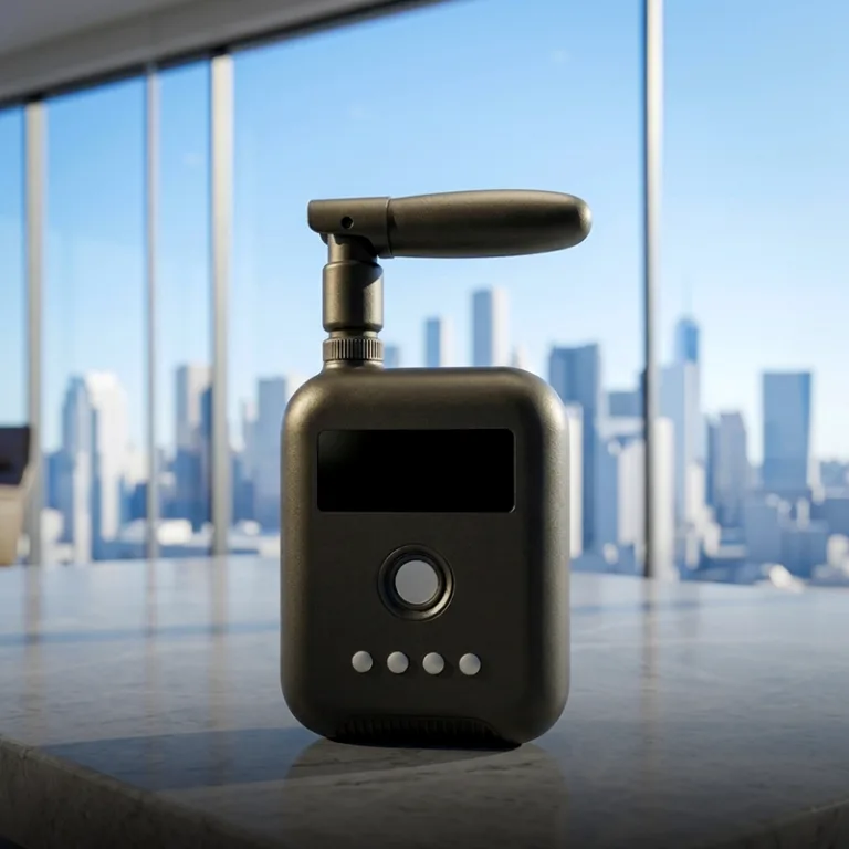
LingSearch serves as the mobile detection and on-site response unit of the Tiruo Innovation low-altitude security system, tailored for individual officer duty, temporary security, and mobile patrol scenarios. It connects to the mobile App via Bluetooth 5.0 to real-time scan Remote ID broadcast signals of drones within a 1.5km radius, supporting functions including target detail viewing, alarm reception, and navigation to pilot locations.
Core Specifications
| Parameter | Index | Description |
|---|---|---|
| Monitoring Range | ≥1.5km (open environment) | Detects Remote ID broadcast signals within a 1.5km radius |
| Antenna Coverage | 360° | Omni-directional detection for wearable mobile operation |
| Weight | ≤60g | Main unit weight capped at 60 grams |
| Battery Life | ≥6 hours | Minimum 6 hours of continuous operation per full charge |
| Connection Interface | Bluetooth 5.0 | Bluetooth 5.0 linkage with mobile App |
| Ingress Protection | IP54 | Suitable for daily field duty environments |
| Main Unit Dimensions | 60mm × 47mm × 20mm | Compact card-style form factor |
| Operating Temperature | -20°C ~ 55°C | Adaptable to outdoor patrol conditions |
| Data Transmission Chain | LingSearch → Bluetooth 5.0 → Mobile App → 4G/5G → MQTT 5.0 → SaaS Cloud Platform | Must be paired with mobile App; cannot upload data to cloud independently |
Detailed Functional Introduction
Wearable Portable Detection
- Ultra-lightweight (≤60g), attachable to epaulets, ID badges, belts or backpack straps
- 360° omni-directional scanning, continuously monitoring surrounding airspace as the wearer moves
- Simultaneous dual-band scanning (2.4GHz / 5.8GHz)
Bluetooth Linkage with Mobile App
- Low-power Bluetooth 5.0 wireless connection
- One-click pairing via device search; full deployment completed within 30 seconds
Real-Time Situational Visualization
- The App homepage displays a map with the user’s GPS location and real-time drone activity nearby
- Target list shows drone model, SN code, altitude, speed, heading angle and pilot coordinates
- Tap any target to open the detail page, with live updates of position and flight trajectory
Instant Alarm Notifications
- Triggers vibration, audio alerts and full-screen pop-ups upon drone detection
- Linked with the SaaS cloud platform for geofence violation alerts and SMS notifications
- Built-in whitelist function: add legal drones on-site to filter false alarms
Incident Navigation & On-Site Disposal
- Generate dedicated incident QR codes; one-click jump to Amap within the App to navigate to the pilot’s location
- Locally store up to 20 latest incident records with complete event metadata
- All incident data synchronized to the SaaS cloud platform to form complete admissible evidence chains
Data Flow
Handheld Terminal · LingSearch (YunScan-Y1)
360° omni-directional detection, 1.5km coverage radius
Bluetooth 5.0
Mobile App
Only renders LingSearch detection data; provides real-time mapping, alarm alerts and navigation
Mobile 4G/5G Cellular Network
(MQTT protocol upload to cloud)
SaaS Cloud Platform
Aggregates LingSearch data; delivers unified situational awareness, alarm management and post-event review
Key Rules
- The mobile App exclusively displays data captured by the LingSearch handheld terminal, excluding data from fixed sentry and airborne SkyEye terminals.
- LingSearch detection data is uploaded to the SaaS cloud platform through the mobile App, where it is fused with data from fixed and airborne terminals.
- LingSearch cannot connect to the cloud independently and must be matched with the supporting mobile App.
Three-Terminal Collaborative Data Links
- Fixed Sentry Terminal (YunScan-F1): Delivers permanent base coverage; data uploaded directly to the SaaS platform
- Handheld LingSearch Terminal (YunScan-Y1): Bluetooth 5.0 → Mobile App → 4G/5G → MQTT 5.0 for cloud transmission
- Airborne SkyEye Terminal (YunScan-Air): OcuSync → DJI Remote Controller → Cellular Network → MQTT for cloud transmission
- Data from all three terminal types integrated on the SaaS cloud platform
Role in the Three-Terminal Collaborative System
| Core Role | Coverage Mode | Final Data Destination |
|---|---|---|
| Mobile blind-spot filling + on-site incident disposal | Dynamic coverage following patrol personnel movement | Mobile App → SaaS Cloud Platform |
- Indoor / underground passages: Ground fixed signals cannot penetrate barriers; LingSearch enables instant detection when carried into enclosed spaces
- Temporary security zones: Concerts, marathons, exhibitions and other venues without permanent monitoring infrastructure
- Target pursuit & on-site inspection: Officers carry LingSearch to approach suspected illegal drone areas and locate pilots
- Mountain & jungle terrain: Fixed ground terminals blocked by landforms; LingSearch fills coverage gaps alongside patrol teams
Typical Application Scenarios
| Scenario | Operation Mode | Core Value |
|---|---|---|
| Public Security SWAT Patrols | Worn by officers during vehicle or foot patrols | Instant alarms upon illegal drone detection; one-tap navigation to pilot position |
| Large-Scale Event Security | Distributed to security staff by zone with unified dispatch | Dynamic full-scene airspace coverage and rapid emergency response |
| Airport Inspection | Worn by security personnel for runway perimeter patrols | Compensates blind zones of fixed equipment for mobile spot checks |
| Emergency Incident Response | Carried by emergency responders to incident sites | Rapid deployment; detection activated within 30 seconds |
| Border Patrol | Equipped for all patrol team members | Fully mobile monitoring with no fixed infrastructure required |
Compliance Standards
- National Standard of China: GB 42590-2023 Safety Requirements for Civil Unmanned Aircraft Systems
- EU Standard: ASD-STAN prEN 4709-002
- US Standard: ASTM F3411
- Communication Protocols: Bluetooth 5.0 + MQTT 5.0
- Deployment Options: Supports private deployment for fully controllable data security